ASAM OpenCRG · mobile mapping
From point cloud to virtual road.
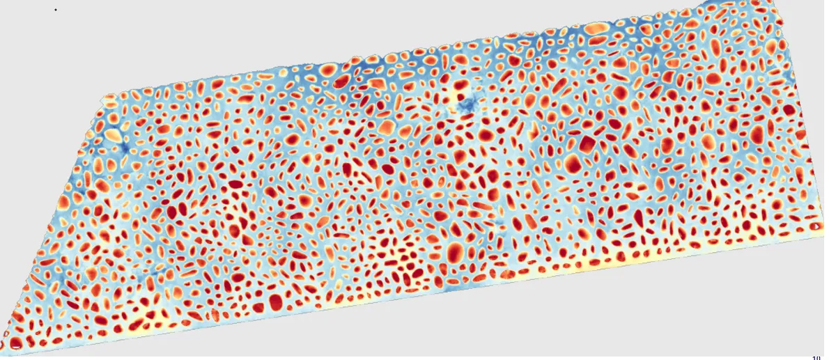
- ASAM OpenCRG 1.1.2+standard road surface format, ASCII or binary
- Grid down to 1 × 1 cmheights on a regular grid along the road
- Mobile LiDARvery dense, homogeneous point cloud
- Simulation-readytested in MSC ADAMS with a tyre model
01 / From scan to simulation
From a scanned road
to an OpenCRG model.
ASAM OpenCRG is the digital standard for a precise, detailed description of a road surface. We build OpenCRG files from our mobile mapping LiDAR data: a regular elevation grid down to 1 × 1 cm along the road, ready for vehicle and tyre simulation.
Mobile mapping capture
Two rotating laser scanners are mounted at the rear of the mapping vehicle’s sensor head. Their scan planes cross behind the vehicle, so the road surface is measured from two directions. For an OpenCRG model, capture runs at a much higher point density than in standard mapping.
Dense, homogeneous point cloud
Road-surface point cloud
The scan output is an LAS point cloud that goes through cleaning and automatic classification. Only road-surface points remain for further processing. Vegetation, vehicles, off-road terrain and measurement noise are removed.
Input: LAS point cloud
Road reference line
A reference line running along the road sets the direction and extent of the model. The position of every measured surface point is expressed relative to this line by a longitudinal and a lateral coordinate.
Position along and across the road
Conversion to the OpenCRG format
The measured surface is converted into a regular grid of height values, at a resolution set by the project requirements, down to 1 × 1 cm. The result is an OpenCRG file ready for use in simulation.
Output: OpenCRG grid
Use in simulation
A virtual vehicle drives over the digital model of the measured road. In MSC Adams we can follow how the unevenness affects the force between tyre and road. The animation illustrates this principle.
Simulation in MSC Adams
02 / Test surfaces
Where a flat road model
is not enough.
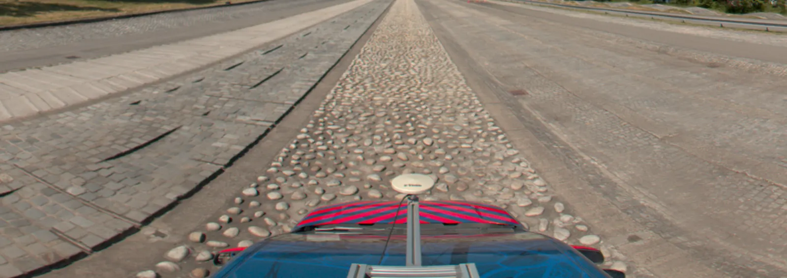
Cobblestones, paving and rough sections of vehicle test tracks shape how tyres and suspensions behave. The OpenCRG model keeps each stone and joint, so the simulation drives over the real surface.
03 / Deliverables
What you
receive.
A road segment defined by its start and end, its width, slope, heading and elevation, in a compact format that loads quickly and needs little memory.
ASCII or binary file with the reference line and the elevation grid of the measured segment.
Regular grid in u/v coordinates, resolution agreed per project.
The primary point cloud used to calculate the OpenCRG model, supplied automatically if you request it.
04 / Virtual vehicle
Škoda Enyaq,
modelled part by part.
The road model is one half of the simulation. The other half is the vehicle: axle kinematics, springs and dampers, wheel and tyre. With our partner, Brno University of Technology, we provide virtual vehicle models that drive over the OpenCRG surface.
- Axle and suspension kinematics
- Springs, dampers and bushings
- Wheel, hub and tyre
- Complete model of the whole vehicle, Škoda Enyaq iV
- Ready for multibody simulation, e.g. MSC ADAMS
05 / How it works
You choose the section.
We deliver the road.
The cleaner and drier the surface, the more faithful the model. A little preparation on site pays off in the data.

Playing the video connects you to YouTube. Open on YouTube ↗
- 01
Define the section
Send us the location, length and width of the road or test track and the grid resolution your simulation needs.
- 02
Clean the surface
Remove fallen leaves, stones, weeds and other obstacles, so the structure of the surface is exposed and stays clean.
- 03
Set a date
We scan in good weather, never in rain, snow or strong wind. A dry surface avoids reflections and uneven returns that distort the data.
- 04
Scan, process and deliver
We capture the section, clean and classify the point cloud, build the reference line and grid, and hand over checked OpenCRG files.
Let's talk
Need your road
in simulation?
Tell us which section you need surveyed. We will agree the scope of scanning and processing together.